
Services

Old plans, made into living maps

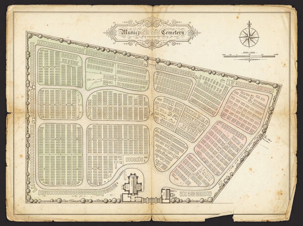
Cemetery section plans, estate maps and town plans, many drawn by hand generations ago, scanned, cleaned up and traced into accurate digital maps on real-world coordinates, with every plot linked to its record.

How it works

From plan to map

  1. No. 01

    Scanned whole

    Plans from A4 to A0 and beyond, scanned full size and in full colour, however faded or fragile.

  2. No. 02

    Joined into one map

    Section plans and maps in several sheets joined into one continuous map, set on real-world coordinates.

  3. No. 03

    Traced by hand, layer by layer

    Plots, paths, buildings, boundaries and trees drawn as separate shapes, so each can carry its own record.

  4. No. 04

    Linked to the records

    Every grave or plot linked to its burial or estate record, and checked before the map goes live.

  5. No. 05

    History kept

    The original plan stays beneath as a historic layer, so nothing it records is lost.

  6. No. 06

    Ready for your software

    Delivered for Epilog Cloud mapping, or as GeoJSON for your own mapping or GIS software.

Cemeteries

Every grave, on the map

Many cemeteries are still recorded on section plans drawn by hand. We join them into one map, trace every grave and link each to its burial record, so staff can find a grave in seconds and see at a glance what space is left.

Where an aerial survey has been flown, the old plans are realigned to it, so the map matches the ground. In Epilog Cloud, made by our sister company Gower, the finished map becomes the base for full historic tracking of every plot.

Estates and heritage houses

Centuries of a landscape, in layers

Estate maps record how a park, its avenues, water and farms changed over generations. We scan each plan and trace it into a digital map that can be laid over the others and over the ground today, for estate management, conservation plans and visitors.

For Boughton House in Northamptonshire we scanned the park plans of around 1705 and restored their colours, so clearly that the variety of each tree can be told.

Project

Cemetery maps for councils

Illustration

Across the UK · Plans from the 19th century to today

Cemetery map digitising for councils

Hand-drawn cemetery section plans scanned, joined into one map and traced plot by plot, with every grave linked to its burial record, for councils and crematoria across the UK.

Drawn as its own shape and linked to its burial record
Every grave
From many section plans, on real-world coordinates
One map
Or straight into Epilog Cloud mapping
GeoJSON
FAQs

Questions

What do you need from us?

Your plans, in whatever state they are in, and the burial or estate records you want linked to them. We collect them, or you bring them to the studio.

What format is the finished map?

A digital map for Epilog Cloud, or GeoJSON for your own mapping or GIS software.

How is digitising priced?

By the number of features drawn on the map: graves, buildings, trees and so on. Where no one has counted them, we estimate from the area. The price calculator gives an example figure.

Do we need a drone survey as well?

Not always. Digitising works from your plans alone. A drone or LiDAR survey adds an accurate map of the ground today for the old plans to be aligned to.

Turn your plans into a map

Tell us what you hold, or work out an indicative cost first.

Get a quote

Tell us about your originals and we will come back with advice and a quote.

We use these details only to reply to you. See our privacy policy.