
Who we help

Prove the land you own

Farms and estates held for generations often rest on maps centuries old. We scan, restore and digitise them, so you can show exactly what your family has held, field by field, and sometimes find land the deeds have forgotten.

For landowners

Old maps can prove new acres

The Land Registry is digital, but its records reach back only so far. Families and estates that have held land for centuries prove what they own with the original maps and their descriptions. Scanned, they can show land the deeds have forgotten.

Land the map proves
£200,000
To scan the map, about
£500
Ask about your estate maps

An illustration, not a valuation or legal advice: land values vary, and whether a map supports a claim is for your solicitor and the Land Registry.

What we scan for landowners

  1. No. 01

    Estate and farm maps

    Hand-drawn maps of fields, woods and boundaries, scanned whole and in colour.

  2. No. 02

    Enclosure and tithe maps

    The maps and awards that fixed who owned what, and where.

  3. No. 03

    Deeds and conveyances

    Title deeds and conveyances, scanned and transcribed so they can be searched.

  4. No. 04

    Field books and terriers

    The written surveys that describe each field, its name and its size.

  5. No. 05

    Rent and account books

    Records of tenancies and rents that show the land in use.

  6. No. 06

    Digital maps

    Old boundaries traced into maps for today’s farm and estate software.

Why it matters

Here is the map, and here is the description

Much of England has been held by the same families since long before the Land Registry existed. When boundaries are questioned, or land is registered for the first time, what counts is the evidence: the old map, and the description of the land that went with it.

Those maps are often fragile, faded and folded into a drawer. Scanned and restored, every field and boundary can be read again and set against the land as it is today, and the original can go back into safe keeping.

  • Every field’s name, shape and acreage legible again
  • Boundaries that can be laid over today’s maps
  • A complete record to hand to your solicitor or the Land Registry
Project

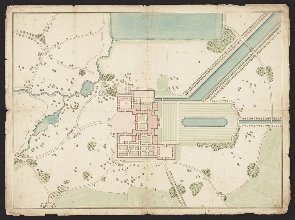
Boughton House, the English Versailles

Illustration

In the news

Near Kettering, Northamptonshire · c. 1705

Boughton House park plans

The original plans of the park at Boughton House, the “English Versailles”, scanned and restored to their colours, from which the park is being replanted 300 years on.

The date of the park plans
c. 1705
Scanned in full colour, then restored on screen
Full size
The width of the lost channel the scan revealed
50 ft
FAQs

Questions landowners ask

Can an old map really add land to my title?

It can be the evidence that shows what your family has held. Whether it changes your registered title is for your solicitor and the Land Registry; we make sure the map can be read and relied on.

How much does it cost to scan estate maps?

Typically a few hundred pounds for a set of farm or estate maps, depending on their size, number and condition. Tell us what you have and we will quote.

Do you need to take the maps away?

We can collect them in fireproof boxes and return them safely, or you can bring them to the studio in Pytchley.

Bring us your oldest maps

Tell us what you hold, and we will suggest the best way to preserve it.

Get a quote

Tell us about your originals and we will come back with advice and a quote.

We use these details only to reply to you. See our privacy policy.